Topic 1: Introduction to Drones in Agriculture
| Site: | TAFE SA Learn |
| Course: | Micro-credential - Drones in Agriculture |
| Book: | Topic 1: Introduction to Drones in Agriculture |
| Printed by: | Guest user |
| Date: | Tuesday, 23 September 2025, 12:59 AM |
Description
Use the link above to access the content or use the table of contents to the right to move between chapters when you revisit this information. Use 'Next' and 'Previous' to move between the pages.
If your preference is to use an alternative format you will find the option in each topic just below the books.
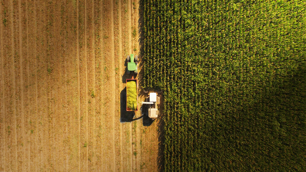
Image used under license from Shutterstock.com
1. Drones in agriculture
The recent growth in the ag-tech industries is altering the way agriculture organisations are managing their businesses. The ability to gather, monitor and analyse critical data is now forming a vital component of the farming landscape. Recent advancements in Drone technology and applications have begun to alter the way organisations approach their business operations.
There’s a long history of air-based systems being used as a compliment to farm operations. Satellite imagery has been used for large scale crop and soil analysis as well as weather and climate monitoring. Both fixed wing and helicopters are widely used for aerial photography, mapping, pest control and herd management. The advent of drone technology is allowing farmers and farm managers to deliver a more localised and timely set of outcomes at a lower cost.
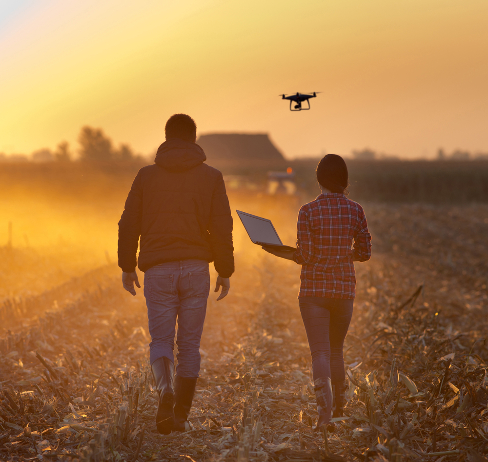
Image used
under license from Shutterstock.com
View drone imagery versus google maps by clicking the URL link below:
https://www.theaeroscout.com.au/2016/06/drone-vs-google-imagery.html
1.1. Putting your drone to work on the farm
Part of the challenge when introducing new technology into any business is to understand how it can best fit their requirements. What can it do for you? How best can I spend my money? What can the technology do to release my more valuable resources to other important work? Understanding a little about the capability and mapping it to what you do now is a good place to start.

Image used
under license from Shutterstock.com
1.2. Basic photography
At its simplest, most drones on the market today are nothing more than a flying camera. This can be a valuable tool for any farm environment. Using the on-board camera to deliver real time geo located images (both still and video) of your property can replace the need to move across the landscape to monitor and assess. Things such as:
- water and irrigation stations
- Irrigation pumps and dams
- fencing and farm infrastructure,
- weather damage
- plant count and identification
- stock management.
- feed troughs and distribution
- feral animal damage
- crop yield
These are all activities that can be observed by images from the drone.
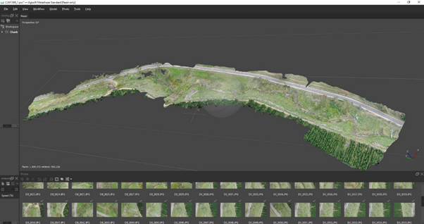
Complimentary to the fast-paced advancement in the physical hardware of drone devices has been the growth and innovation of business-related software and applications. As useful as a simple set of photographs or videos from a drone may be, the real value comes when these images are processed into other outputs or products. Software houses have developed software that can process your images into a valuable set of outcomes. They can create stitched or orthostatic views merging many images into one for a large high def view of a location. They can process these images to form 3D terrain models as well as geo located height maps. With special filters or purpose-built multispectral cameras, applications are available to create colour maps indicating plant and crop health as well as soil and irrigation issues.
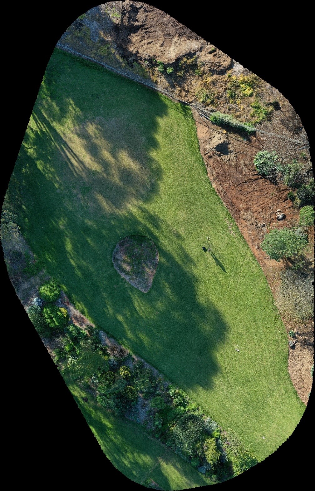
An example of a golf fairway area at Urrbrae using different cameras and processing.
Orthostatic
view: Stitched image combining several HD images
Drone: DJI Mavic Pro 2
Camera: Hasselblad
Processing Software: Maps Made Easy
Image license: TAFESA
Check your knowledge using the quiz below.
1.3. More than just photos
Most entry level drones are easy to fly and can be productive with minimal training or technical understanding. However more and more, hardware and software innovations and miniaturization of is offering greater capability than just photography. Special camera systems such as multispectral and infrared devices are entering the market at lower prices. Advanced mapping systems such as Lidar and high accuracy GPS are also becoming adaptable to farm use. Larger drones are often required for some of this equipment as the payloads are larger. One area very familiar to the farm community is pest and disease management with aerial spraying. Larger higher powered UAV devices can distribute tanks of chemical spray or even be used for aerial seeding.
Take a look at this Queensland Drones Company's website using this link below:
Agricultural Drones Australia | Oztech Drones for Farmers Queensland
Some newer implementations are using the drone as the targeting and mapping device while ground based autonomous vehicles with advanced AI systems apply the chemical to a very specific area. This type of weed management helps reduce waste while minimising the risk of contamination across paddocks through drift.
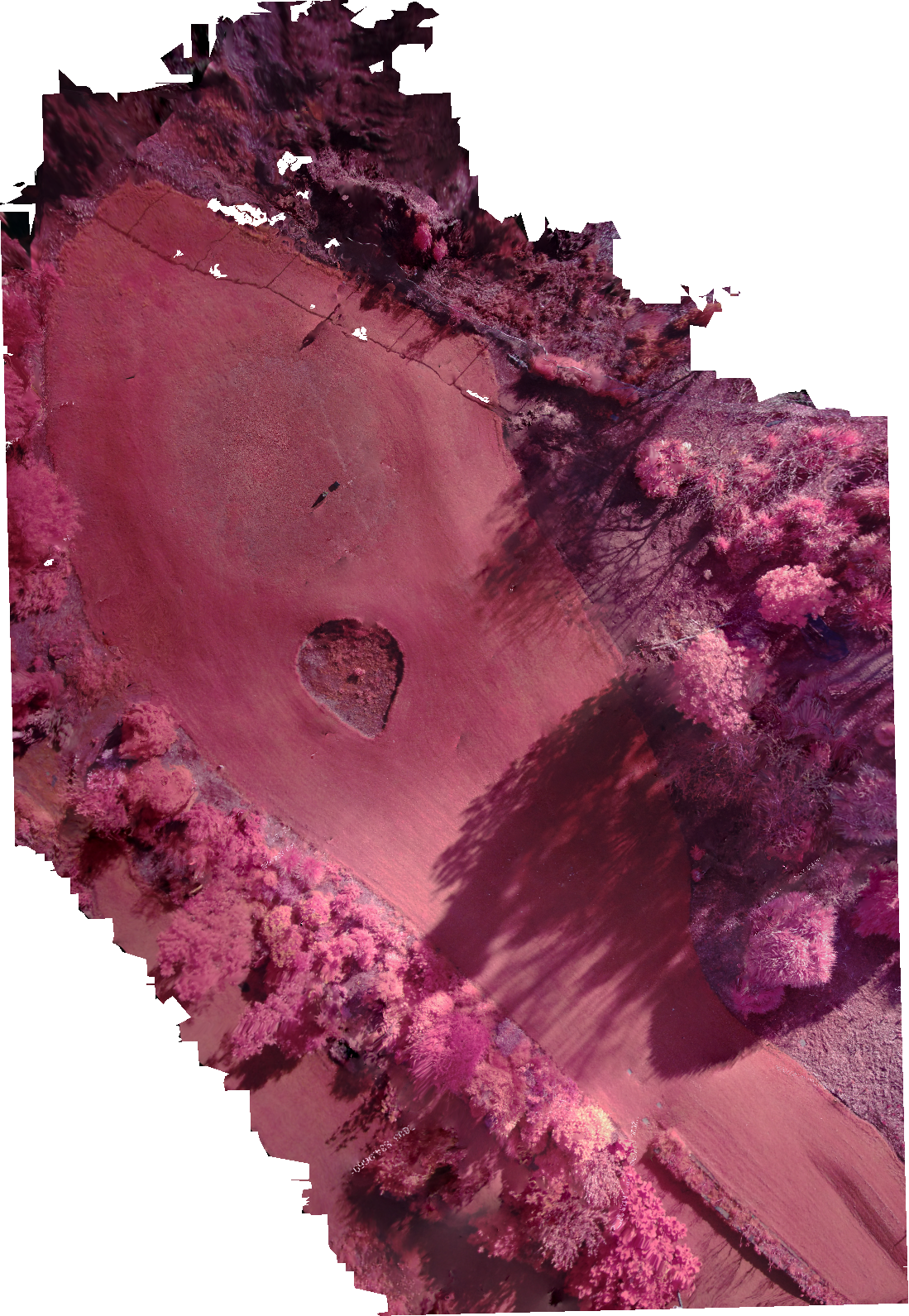
Image of a golf fairway area at Urrbrae and show a site of images
using different cameras and processing.
NIR: Stitched image combining
several near infrared images
Drone: DJI Mavic Pro 2
Camera: AgroCam (additional
mount under drone)
Processing Software: AgroCam
cloud processing
Image license: TAFE SA
2. Early detection and timely prevention
Early detection of any potential problems is critical to any business. Understanding the health of the crop or the condition of the soil of the paddock is a fundamental skill the farmer or farm manager must have. Unlike people, plants can’t tell us when they are not well. With some special tools and creative software, it’s now possible to have drones give the farmer some help.
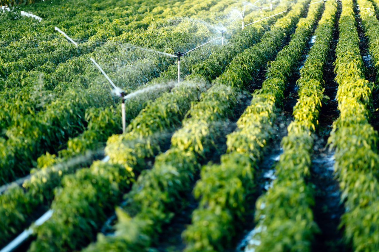
Image used
under license from Shutterstock.com
Check your knowledge using the quiz below.
2.1. Measure plant health and identify crop stress
The key to mapping plant health is to understand that healthy plants reflect light differently to stressed or unhealthy plants.
Light can be broken down into different colour bands or wavelengths. You can see this visible spectrum when white light is projected through a prism. Just like a rainbow.
There is another wavelength that sits just outside this visible spectrum called near infrared. By understanding how plants reflect or absorb this light it is possible to get an indication of the plant’s health.
Plants that are healthy reflect more green light than red and reflect more near infrared. Unhealthy plants absorb far more near infrared. By detecting this separation, a calculation can be made, and a value assigned to each area. This index value is referred to as NDVI or Normalized Difference Vegetation Index.
To find out more you can click on the URL link below.
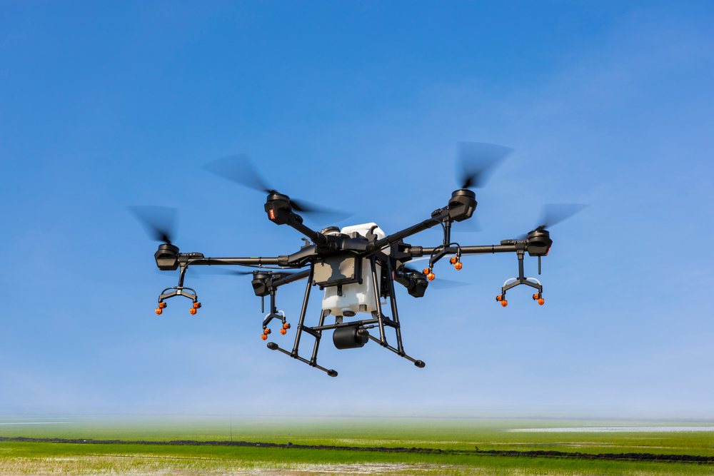
Image used
under license from Shutterstock.com
This technology has been established for some time and was first applied at a large scale in 1972 with the Landsat satellite. Large continental and state images of vegetation health have been available for ag management across the world. The advantage to farmers now is that this technology is available at your local level and can be focussed on just your patch.
Look at this website by clicking on the URL link below to see examples of Normalized Difference Vegetation Index (NDVI)
https://gisgeography.com/ndvi-normalized-difference-vegetation-index/
For a farmer or farm manager to use this NDVI index they would need the appropriate camera system to capture the different bands of reflected light. Standard cameras have a filter to stop the near infrared affecting the colour of the pictures. Purpose built multispectral cameras are available that are designed to allow this light through. These images are them processed through specific software applications to produce a colour map of your crop or field. Colours range from green being healthy, to red being stressed. Though these images are only an indicator, they can be an excellent way to assess a large area and focus on particular areas of concern. Using this process is easy and can give access to a series of images over a period to give a progressive view of your environment. Using this approach can indicate other issues in your environment as well such as irrigation issues, invasive weed activity, soil condition and new crop growth.
To find out more about things to know about NDVI click on the URL link below.
(Normalized Difference Vegetation Index) [2.24]
3. An aerial view of your land
What's possible when you can get an aerial view of your land?
3.1. Make informed decisions about your environment
Getting a new view or perspective of your property may present new opportunities to your business. As we have discussed, photography can be used in a variety of ways to present different outcomes from the same image set from the same flight. Aerial photography is a powerful tool and can be used for a variety of outcomes to the user. One challenge is that drones used in large environments are limited in the amount of landscape they can capture in each single image. This problem is overcome by using a series of overlapping images and having them digitally stitched together to produce a wider single orthostatic view. These merged views combine a series of high-definition picture to form one image. This helps analyse your environment without flicking image after image.
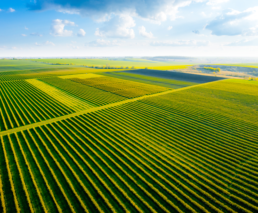
Image used
under license from Shutterstock.com
There are a variety of software products and services that can do this. Farmers who do not have a lot of flight training can take advantage of software that can help with mission flights. These are flights that are setup across a defined area in advance. The drone flies in a specific grid pattern, takes the photos at intervals and returns home when the mission is complete. These larger images are excellent for a broader evaluation of your property. They can be used for vegetation calculations, orchard mapping, and forest analysis as well as creek and erosion changes. They can also be helpful as before and after images to analyse changes over time. As the drone is not hampered by boggy or hard to access terrain, the drone images can give a live view of the state of your property. This could be particularly useful after major weather or fire events.
To see before and after images showing the scale of bushfire devastation click on the URL link below.
https://www.theguardian.com/australia-news/2020/jan/17/before-and-after-images-show-scale-of-bushfire-devastation
Advanced GPS systems on many drones enable GEO located photo formats such as .TIFF to have GPS location information imbedded in file. These photos can be exported into advance GIS (Global Information Systems) applications such as ArcGIS or QGIs for more advanced mapping, surveying, and area management.
3.2. Using photogrammetry form your flight images
One area that is increasingly being used in land management and mining is surveying with drones. With the right flight path and similar set of images you can create detailed 3D models and height maps of your environment. This can be useful to understand slopes, water movement and erosion points on your property. Also, terrain damage such as goat tracks, vehicles, and rabbit warrens.
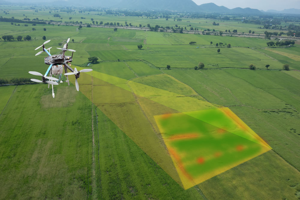
Image used
under license from Shutterstock.com
3.3. What is photogrammetry
Photogrammetry is defined by the American Society for Photogrammetry and Remote Sensing (ASPRS) as “the art, science, and technology of obtaining reliable information about physical objects and the environment, through processes of recording, measuring, and interpreting imagery and digital representations of energy patterns derived from noncontact sensor systems” (Colwell, 1997:3).
It sounds complicated and at the software processing level it is. From a user perspective its quite a simple process. What photogrammetry enables you to do, is by creating a series of overlapping images of your property, the software pattern matches each photo image to image and triangulates a series of 3D points called a point cloud. This point cloud can then be processed into a 3D model or mesh with an image of the area overlayed as a texture.
This model is both Geo located and be used to get accurate heights and volumes. It can be used to measure the size of dams or cutaways or the fall of slopes and depressions. Some services are available online that can process all the images and produce the model, a stitched orthostatic high-def image as well as geo located heights maps all from the one set up photos.
An image of a stitched orthostatic high-def image/Source: Conservation at Ecosystem Management TAFE SA
This model is both Geo located and be used to get accurate heights and volumes. It can be used to measure the size of dams or cutaways or the fall of slopes and depressions. Some services are available online that can process all the images and produce the model, a stitched orthostatic high-def image as well as geo located heights maps all from the one set up photos.
Have a look at this website by clicking on the link below to see some good examples of what can be done and what outputs to expect:
Maps Made Easy - Samples
If you haven't already subscribed to 'farmers weekly' have a look at their website to see what great information they provide. They are a US site however it still contains valuable information. Click on the URL link below:
https://www.farmersweekly.co.za/agri-business/agribusinesses/how-super-detailed-drone-mapping-is-changing-farming-forever/
Farmers who do not have a lot of
flight training can take advantage of software that can help with mission
flights. These are flights that are setup in advance over a defined mapping
area. The drone flies in a specific grid pattern, takes the photos at
pre-defined intervals and returns home when the mission is complete. The images
are them uploaded to the cloud and the maps produce. These services limit the
amount of expensive computing equipment and expertise required to produce such
output.
One note regarding photogrammetry. When creating models for terrain it works best for areas where vegetation is sparse. The process looks only at the image and note the actual ground height. It calculates the tops of plants as the level of terrain. To get an accurate level of the ground terrain, technology like Lidar would need to be deployed.
Check your knowledge using the quiz below.
3.4. What is Lidar
Lidar is a method for determining
ranges by targeting an object with a laser and measuring the time for the
reflected light to return to the receiver.
Lidar is a type of mapping technology that is gradually becoming available on drones. They require larger or specialist aircraft to use however like a lot of products in this space they are becoming more accessible. The main advantage for the use of Lidar is it is better at mapping terrain with vegetation. The fast-spinning laser can fire through the gaps in leaves, bounce off the ground and back. In some surveying and mapping projects this accuracy would be required. For the general farmer it may be the type of service you would outsource, however it is a technology that is developing and may become more useful than just terrain mapping.
For more information about drone photogrammetry vs. LIDAR and what sensor to choose for a given application click on the URL link below;
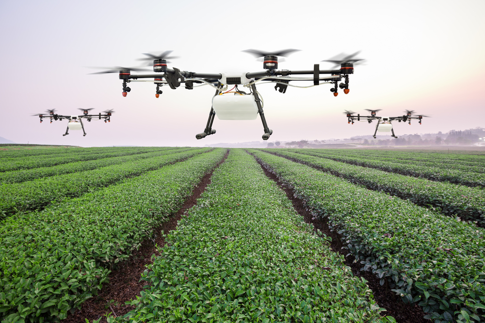
Image used
under license from Shutterstock.com
Check your knowledge using the quiz below.
4. Thermal imaging
Thermal imaging cameras are also being developed for deployment by drones. These cameras detect the heat off surfaces through a specific wavelength of light. This infrared light is invisible to the naked eye but when processed with the appropriate equipment the radiation is converted into an image we can see. Night vision and advanced military systems have used this for some time.
Image used under license from Shutterstock.com
4.1. What a farmer might want to see
The availability of this technology for a farmer opens a new set of tools for them to utilise. Implementations for feral animal management such as dear, rabbits or wild pigs are being used now. These introduced species cause enormous amounts of damage and high cost to the farmer. Tracking and eradicating them can be a complex and labour-intensive exercise. The use of this technology vastly improves the management of these animals at a relatively low cost. The same technology can also be used to find lost animals in dense and difficult to access terrain.
This same imaging system can also help with animal management. Research has been done shown that thermal imaging of cattle and sheep can help identify sick or stressed livestock. The monitoring of body temperature can give early indications of an outbreak of disease. Early identification and treatment can limit the impact over the entire heard.
You will find some examples of thermal imaging and how thermal imaging is changing the future of livestock here:
https://www.rocketmine.com/how-drone-tech-is-changing-the-future-livestock-farming/5. Herd Management
Whatever the size of herd or the lands upon which they graze, monitoring and moving stock can be effectively carried out by drones. Drones For livestock management is the next logical step in agricultural technology.
5.1. A new kind of mustering
In many parts of Australia, particularly in the north, helicopters and light aircraft are used to herd cattle. Using drones to manage livestock is an obvious next step. Work is being done using drones along with devices such as GPS collars to track and monitor cattle from the air. As we covered in the Thermal imaging topic, advanced camera systems are giving farmers greater capability at lower cost.
Having drones move around a herd several times of the day checking for unhealthy or injured animals saves both time and money. Monitoring the health of animals by observing their behaviour can help identify health issues early. Animals lying down or separated from herd when normally massed in the group may indicate early onset of a problem. This daily analysis can occur at regular intervals, even if the terrain is impenetrable following floods or fire.
Watch this footage of a grazier in central Queensland. Will Wilson has mustered a thousand head of cattle just by lifting a finger, and it worked so well he is considering adding a full-time pilot to his workforce [2.27].
Watch this footage to see cattle mustering using drones.
Work is also being done using drones to muster cattle and manage the movement of stock around the property. Not only is this a cheap efficient method of farm management, but it also helps reduce the risk of farm injuries.
WHS statistics relating to quad and two-wheel bike injures are significant. Though this technology does not replace the need for farm staff, if can be used strategically to improve the work environment and overall productivity of the business.
6. Topic wrap up
Complete the Activity and Discussion Forum to wrap up this chapter
Activity
Discussion Forum
Complete the Activity and Discussion Forum to wrap up this chapter
Activity
Discussion Forum
Discussion Forum