
1. Drones in agriculture
1.3. More than just photos
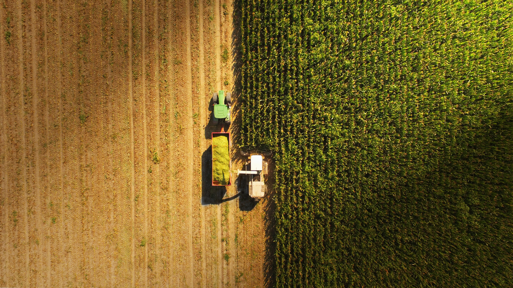
Most entry level drones are easy to fly and can be productive with minimal training or technical understanding. However more and more, hardware and software innovations and miniaturization of is offering greater capability than just photography. Special camera systems such as multispectral and infrared devices are entering the market at lower prices. Advanced mapping systems such as Lidar and high accuracy GPS are also becoming adaptable to farm use. Larger drones are often required for some of this equipment as the payloads are larger. One area very familiar to the farm community is pest and disease management with aerial spraying. Larger higher powered UAV devices can distribute tanks of chemical spray or even be used for aerial seeding.
Take a look at this Queensland Drones Company's website using this link below:
Agricultural Drones Australia | Oztech Drones for Farmers Queensland
Some newer implementations are using the drone as the targeting and mapping device while ground based autonomous vehicles with advanced AI systems apply the chemical to a very specific area. This type of weed management helps reduce waste while minimising the risk of contamination across paddocks through drift.
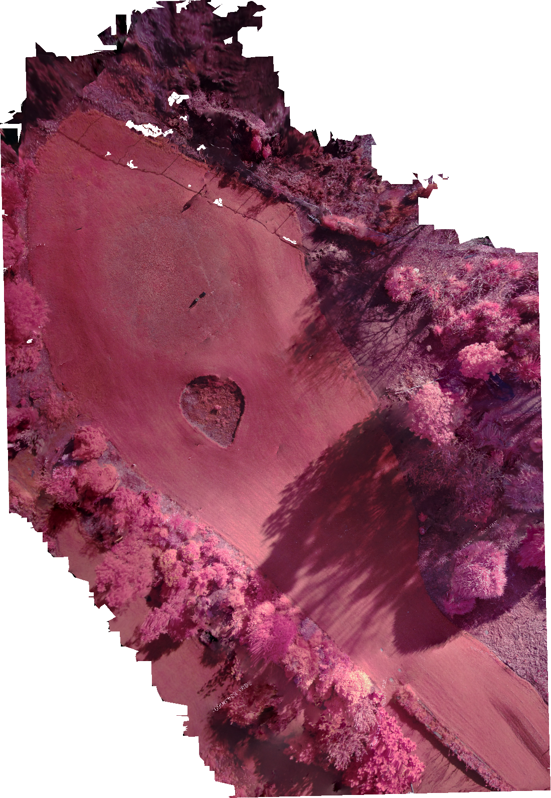
Image of a golf fairway area at Urrbrae and show a site of images
using different cameras and processing.
NIR: Stitched image combining
several near infrared images
Drone: DJI Mavic Pro 2
Camera: AgroCam (additional
mount under drone)
Processing Software: AgroCam
cloud processing
Image license: TAFE SA